Free Download Geothermal Prospectivity Mapping
Published 10/2025
MP4 | Video: h264, 1280x720 | Audio: AAC, 44.1 KHz, 2 Ch
Language: English | Duration: 7h 56m | Size: 5.15 GB
Using Integrated GIS, Remote-Sensing and Geophysical Techniques.
What you'll learn
Using satellite imagery to detect structural lineaments and fractures.
Identify zones with high geothermal gradients and subsurface temperatures.
Delineate heat sources (magma bodies, deep fractures, faults).
Automate repetitive tasks in oasis montaj software
Using Python to automate the process of diving a grid into several overlapping blocks
Requirements
Oasis montaj, Global Mapper, ArcMap, Qgis, Surfer, PCI Geomatica, Python, Visual studio code, ENVI and Google earth pro installed on a PC
Description
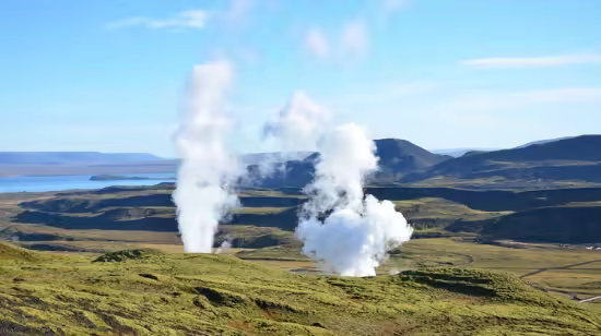
Geothermal energy is heat derived from within the earth. It is a clean, renewable resource because the heat is continuously produced inside the Earth's core by the slow decay of radioactive particles. This immense heat can be harnessed to generate electricity, heat and cool buildings, and for various direct-use applications.Geothermal Energy Prospecting and Mapping involves identifying and characterizing areas where heat from the Earth's interior can be harnessed for energy production. This process combines geological, geophysical and remote sensing methods to locate subsurface heat sources, permeable reservoirs, and fluid pathways. The ultimate goal is to de-risk projects by pinpointing the most promising locations for drilling, which is the most expensive part of development.Several parameters which need to be considered for an optimum occurrence of geothermal resources are shallow Curie point depths, high-temperature gradients, high heat production, low regional gravity anomalies, the presence of structural lineaments, hot or warm spring locations, as well as the outcropping of younger volcanic or granitic rocks, among many others. The faulted/fractured structural pattern enhances the permeability of rocks. It enables the easy transportation of hot fluids from the Earth's interior to the surface. Hot/warm springs indicate the occurrence of geothermal energy resources within the subsurface. Additionally, the occurrence of volcanic rocks serve as cap rocks in some known geothermal locations. The low gravity anomaly indicates the localization of volcanoes that appeared within the Earth's sub-surface. Furthermore, the shallow CPDs and the high-temperature gradients show the high possibility of geothermal resources
Who this course is for
A student/researcher curious about geophysical and remote sensing data analysis
Homepage
Code:
Bitte
Anmelden
oder
Registrieren
um Code Inhalt zu sehen!
Recommend Download Link Hight Speed | Please Say Thanks Keep Topic Live
Code:
Bitte
Anmelden
oder
Registrieren
um Code Inhalt zu sehen!